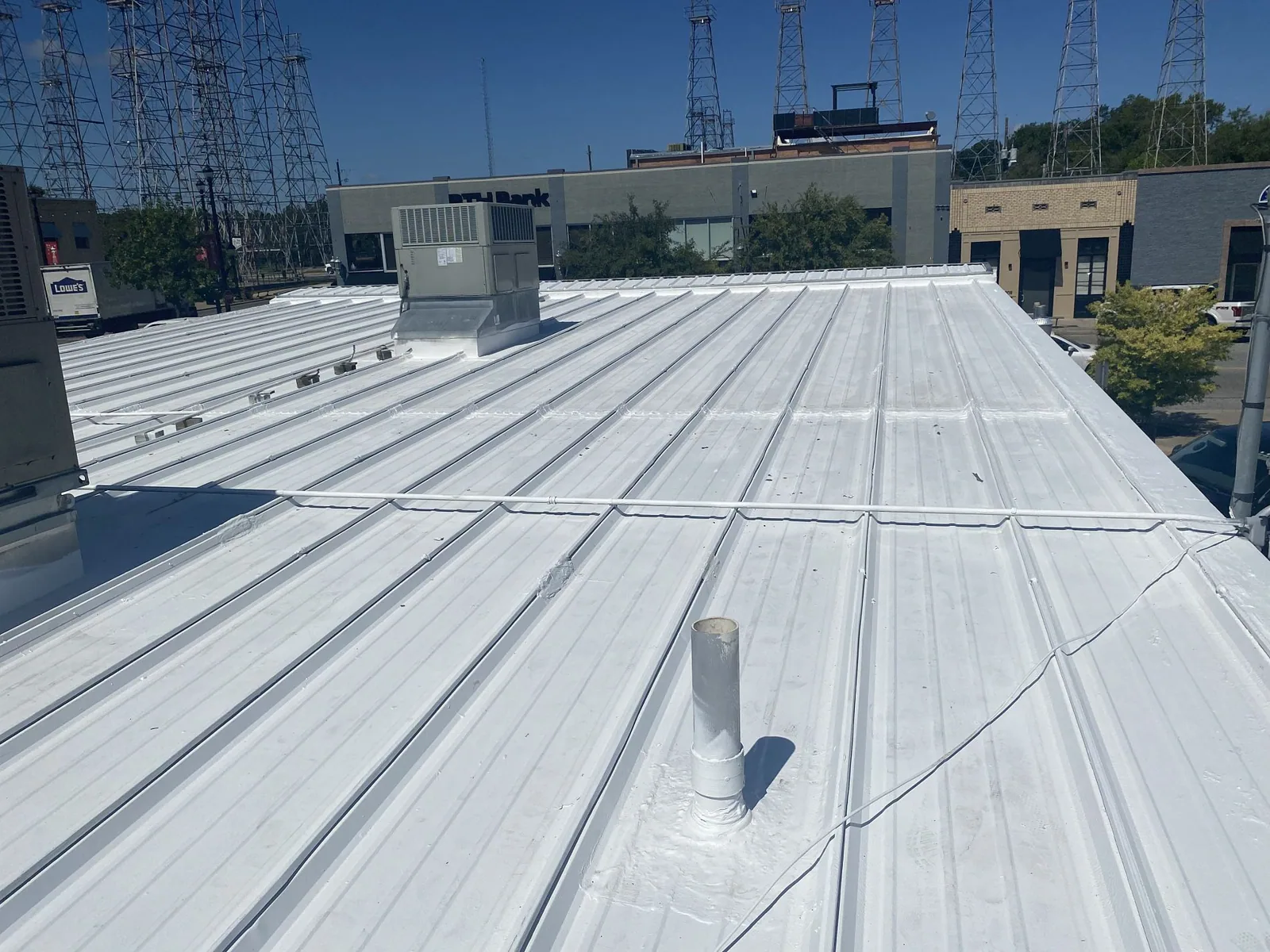
Drone Roof Inspection in Allen, TX
Large roof fields can be difficult to document from a ladder or hatch alone. Drone imagery gives a facility director a broad view of membrane surfaces, equipment layout, drainage paths, and areas that need closer review. It is a way to observe parts of a roof, not a substitute for checking seams or confirming moisture below the surface. Allen has office campuses near Watters Creek and varied roof layouts across its commercial districts, so imagery is planned around the property. The flight plan identifies areas imagery can capture and connects findings to a follow-up inspection. For a commercial building in Allen, the deliverable should clarify what the aerial view shows and what still requires a closer assessment.

Get a roof-wide view
Aerial images can help document broad membrane areas, rooftop equipment, visible ponding, debris accumulation, and apparent damage across a large footprint. They can also provide context when several roof sections meet or when an access path limits a ground-level view. We use the imagery to identify locations for closer inspection and to compare visible conditions between sections. The report ties images to roof areas so maintenance staff can connect them with repair logs and building plans.
Drone work is especially useful when the roof has many obstructions, a large footprint, or areas that are difficult to reach safely. It can help survey buildings in Allen's mix of offices, commercial retail, technology, and industrial uses. The business category alone does not tell us what the roof contains, so the imagery is reviewed against visible details and available site information. Aerial images can reveal an apparent seam irregularity or displaced accessory, but a hands-on check may be needed to confirm attachment or material condition. A commercial roof inspection can pair the aerial overview with direct examination of accessible details.
Know what an image cannot confirm
A drone photograph cannot establish whether insulation is wet, a seam is bonded, a fastener is secure, or a roof assembly meets code. Shadows, glare, standing water, equipment, and surface color can affect interpretation. The image may show an area that looks different without explaining its cause. We mark observations as visible conditions and recommend a hands-on review or moisture test when confirmation matters.
Wind, rain, lightning, flight restrictions, and site conditions can also limit when imagery is safe or permitted. We coordinate access and confirm any applicable flight rules before work. If the building is near controlled airspace or a sensitive site, that review may change the method or timing. Drone imagery is not used to create a claim of damage beyond what the images show. For hidden moisture questions, infrared moisture surveying or selective core cuts may be more useful. For close review of a small defect, a technician on the roof can see surface separation and test material behavior directly.
Document broad storm exposure
After a severe weather period, a roof-wide view may help show displaced equipment, debris, visible punctures, or damage patterns across exposed surfaces. North Texas spring thunderstorms can bring hail, damaging winds, flooding, and tornadoes, though an event does not affect every site each year. Use the flight to flag changed areas, then inspect those roof sections directly before setting a repair scope.
We capture images after the roof is safe to access and note any temporary protection already installed. If water is entering the building, emergency dry-in comes before a full imagery survey. We separate visible storm impact from surface aging, prior repairs, and normal equipment shadows. The image set is organized to support a property-level inspection, not stand in for a written repair assessment. A storm-damage roof inspection can confirm whether apparent changes require repair and document the scope of work.
Make the imagery useful to the facility team
The image set should help a facility team make decisions. We identify the building area, flight date, visible conditions, and recommended follow-up. If imagery shows debris blocking a drain, the maintenance team can verify and clear it. If it shows an apparent seam issue, the next step is a closer look to determine whether the seam has separated. An organized visual record also helps compare roof sections across a larger property at future inspections.
Allen's Watters Creek district includes office buildings in a mixed-use setting, while 121 Tech Park serves office, industrial, and technology operations. Roof access, security, and equipment constraints vary across those properties. We coordinate with the site contact so the flight avoids restricted areas and captures the sections needed for the inspection. Aerial visibility still leaves seams, flashings, and accessories to examine closely. The report identifies gaps in coverage and any access limitation, then recommends the direct check that would resolve the open question. The facility director can use that list to plan access and minimize repeat visits.
Combine imagery with roof history
Existing leak reports and repair logs help focus a drone inspection. We use those locations to frame imagery around recurring problem areas, while also capturing context from nearby roof sections. Plans, equipment locations, and known access points can help make the image record easier to use. After review, findings are tied to follow-up work such as hands-on inspection, patching, drain maintenance, or moisture testing.
Allen has adopted the 2021 International Building Code and International Energy Conservation Code. Aerial images can support condition documentation but do not make permit or code determinations. If the next project changes the assembly or roof height, the scope must be evaluated against the applicable requirements. For roofs being tracked over time, roof asset management can organize the imagery with repair and inspection records. A broader condition report helps the team prioritize follow-up by risk and operating impact rather than by image count.
Coordinate a safe survey
We confirm the property contact, safe launch and landing locations, site restrictions, flight window, and areas to capture. Flights may need to avoid people, deliveries, or active construction. Weather conditions matter: wind, precipitation, and low visibility can affect control and image quality. If the site cannot be surveyed safely on the planned day, we coordinate another window rather than force a poor capture.
For occupied commercial sites, the facility director can help identify visitor routes and any sensitive equipment or process areas. We can narrow imagery to the roof sections relevant to a repair question, then recommend whether a more complete inspection is needed. A drone roof inspection works best when the deliverable has a defined purpose, such as mapping visible ponding or photographing hard-to-access sections. It should answer a property question that aerial visibility can support.
Commercial Roofing Questions
Can a drone determine whether my roof has a leak?
It can show visible conditions and help locate areas for inspection, but it cannot trace hidden water paths or confirm wet insulation. A hands-on investigation may be needed.
Does drone imagery replace walking the roof?
No. It provides an aerial overview. Seams, flashings, fasteners, material adhesion, and moisture often need closer examination.
Can you use a drone after hail?
Yes, when weather and flight rules allow. Imagery can document visible conditions, followed by hands-on review of areas where the surface or details appear affected.
What can make a drone survey unavailable?
Wind, rain, lightning, visibility, airspace restrictions, access, or site safety conditions can change the flight plan or timing.
How do you organize the photographs?
Images are associated with the roof sections they show, along with visible observations and any follow-up needed. They can be added to a broader condition record.